
Drone services
Our well-qualified staff is skilled in designing, inspecting and delivering geospatial services by using drones. Our team includes remote sensing PhD holders, Civil Aviation Authority-certified pilots and instructors, surveyors, as well as specialists in GIS, photogrammetric and LiDAR data processing. We also work closely with external experts – dendrologists, botanists, agronomists, hydrologists or geologists.
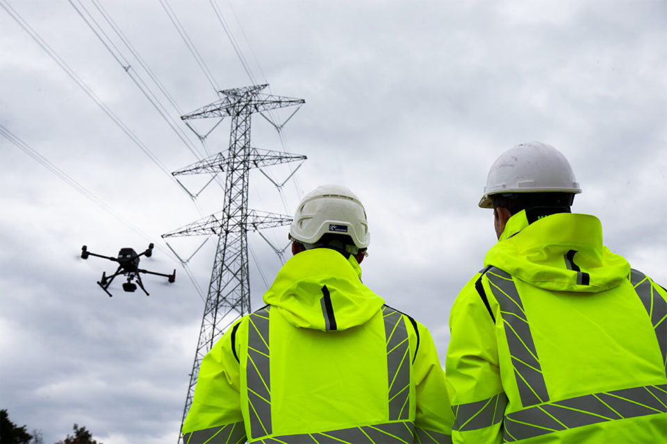
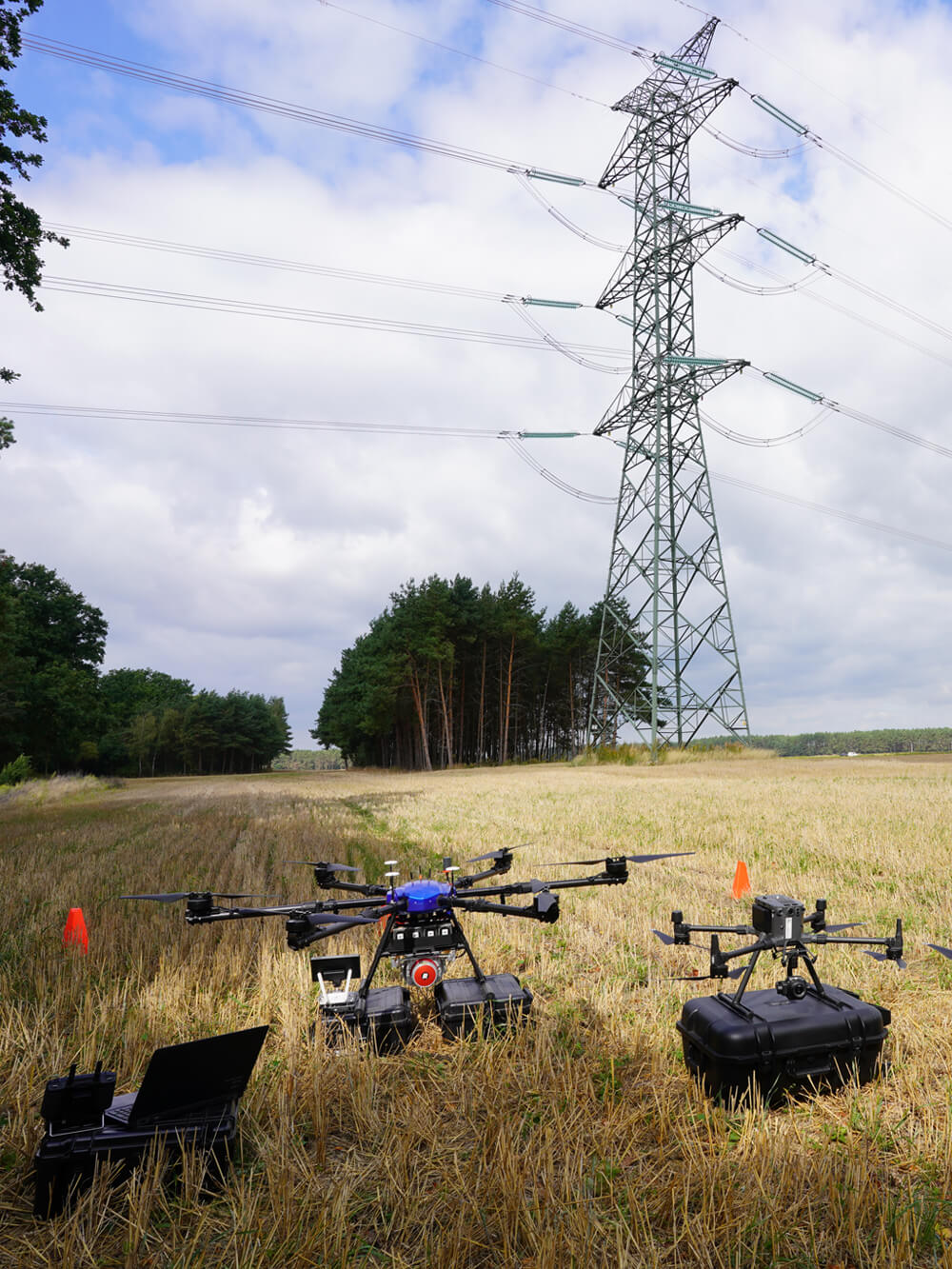
We are pilots with extensive experience and one of the longest lists of certificates and licenses related to flying unmanned aerial vehicles on the market. We have completed large scale projects: creation of complex orthophotomaps, inspections of critical power infrastructure, collection, processing of large data sets and 3D laser scanning.
Not much can surprise us in the field of geospatial services but we welcome new challenges. Our technical proficiency and flexibility, the high level and diversity of our expertise, as well as the quality of our drone fleet together with state-of-the-art payloads, the best available software tools and proven methodologies, allow us to take on any complex task.
Observe more and learn faster from above
We provide support and services for the early phase of the project, designing, execution, as-built documentation and maintenance. Our broad service portfolio allows us to offer effective drone solutions and data analysis in every industry.
- LiDAR laser scanning
- Orthophotomaps
- Project maps
- Photogrammetry
- Point clouds including classification and vectorisation of objects
- Digital surface/terrain models
- Digital 3D asset models
- Thermal, UV and visible light inspections
- Advanced volumetric and spectral analysis
- Stringing transmission lines
- Aerial filming
OUR PILOTS
It would be hard to find a team of UAV pilots with a longer list of certified competencies or more hours flown. We are certified to fly in and out of visual range (VLOS/BVLOS), including the heaviest rotary-wing drones for civilian applications. Our pilots have training up to 140 kg MTOM, instructor certificates and flight time equating to thousands of hours. Being the first pilots in Poland to fly unmanned helicopters with a maximum take-off mass of up to 150 kg, we combine the passion for flying with an educational background in geodesy, remote sensing and mechanics.
- VLOS
- MR25
- UAV(H) 150 kg
- BVLOS
- MTOM 140 kg
- INS
- SPECJALISTYCZNE (SORA)
PAST PROJECTS
We come from the power industry, so our biggest drone projects are related to the planning, construction and modernisation of power lines. Here are some of the recent projects that we are particularly proud of:
- 400 kV Mikułowa-Czarna (LiDAR laser scanning: acquisition, data processing & analysis, oblique inspection images, thermovision and photogrammetry: orthophotomap, DTM, GIS data) – 140 km
- 400 kV Piła Krzewina-Plewiska (powerline stringing, LiDAR laser scanning: acquisition, data processing & analysis, oblique inspection images, thermovision and photogrammetry: orthophotomap, DTM, GIS data) – 100 km
- 220 kV Połaniec-Chmielów, line I and II (LiDAR laser scanning: acquisition, data processing & analysis, photogrammetry: orthophotomap, DTM, GIS data) – 80 km
- 400 kV Połaniec-Rzeszów (LiDAR laser scanning: acquisition, data processing & analysis, photogrammetry: orthophotomap, DTM, GIS data) – 53 km
- 220 kV Puławy-Rożki (LiDAR laser scanning: acquisition, data processing & analysis, photogrammetry: orthophotomap, DTM, GIS data) – 71 km
- 220 kV Adamów-Pabianice (thermovision and RGB insepction) – 75 km
- 220 kV Sieradz-Jawor-Błaszki (photogrammetry and oblique inspection images)
– 20 km - 220 kV Krajnik-Gorzów (photogrammetry and oblique inspection images) – 25 km
- 400 kV Czarna – Pasikurowice (thermovision and RGB insepction) – 52 km
- Construction of S61 road (LiDAR laser scanning: acquisition, data processing & analysis, oblique inspection images, photogrammetry: orthophotomap, DTM, GIS data) – 5 km
- Geospatial data for the construction of new 400 kV power lines (LiDAR laser scanning: acquisition, data processing & analysis, oblique inspection images, thermovision and photogrammetry: orthophotomap, DTM, GIS Analysis) – 224 km²